Analytical Texts
This article is drawn from extracts from PETAA Book The Shape of Text to Come: How image and text work, written by Dr Jon Callow and published in 2013.
At a very simple level, any image can be labelled, with lines and arrows running from the written label to part of the image. Very often the focus is a particular idea or concept, particularly with a factual text. So, for example, a labelled picture of a kangaroo is meant to provide an understanding of the parts of all kangaroos, not just that particular one encountered on a page or screen.
Labels can be used to show place names on a map, identify the parts of a machine or building, describe the various jobs that people did in a history book or name the function of body parts in a health text. The key or legend on a map may also use symbols that label geographic features or show scale and distance. All of these provide a type of analysis of the image. Sometimes images will lack labels, and the viewer must infer from the context or longer written text what the image is meant to represent or show. Both labelled and unlabelled analytical images need appropriate explanation when assisting learners in understanding what they mean.
Some types of analytical images show specific physical features. In the same way that topographical maps show the accurate position and elevation of hills, mountains and other geographical features, so topographical images show a similar degree of accuracy. Diagrams are topographically accurate, in terms of representing an actual object. Hand-drawn illustrations or more complex 'exploded' cut-aways can all represent accurate proportions.
Alternatively, some images don't use scale accuracy, but represent a more generalised or logical view of a system or location, such as representations of how the internet is connected across the globe, or underground train systems such as those in London, New York or Paris. These representations are sometimes referred to as topologically accurate.
London Underground Map:
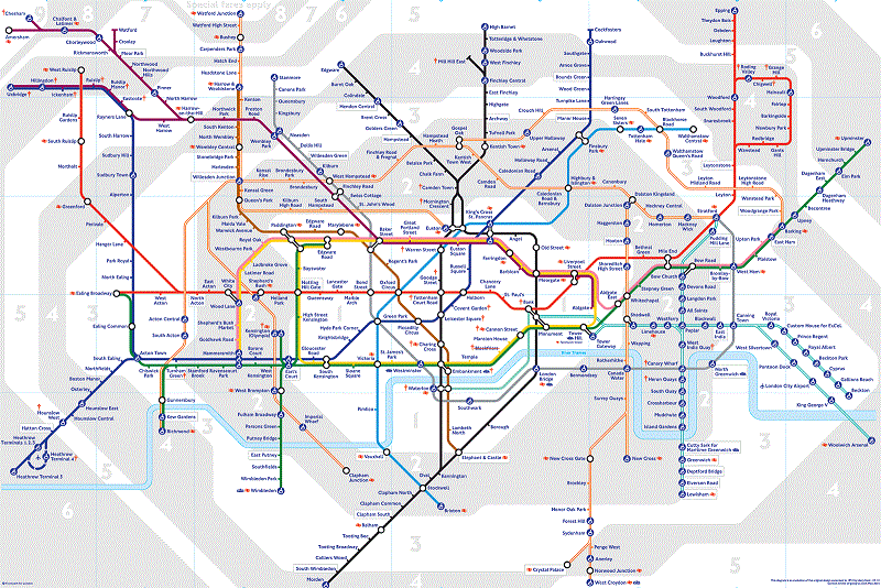
Sourced from BBC: https://www.bbc.co.uk/london/travel/downloads/tube_map.html